


WSDOT
WSDOT
When I need a quick picture of what is happening on Washington roads, I prefer an official source over a collection of scattered posts and guesses. That is where WSDOT makes sense. This free Travel & Local app comes from the Washington State Department of Transportation, or WSDOT, and is built around traffic and travel information for Washington. I found it most useful as a practical decision-making tool: check the route, look for trouble ahead, and decide whether to leave now, change plans, or use another road.
It is not the kind of app I open for entertainment, and it does not try to replace every navigation service on my phone. Its value is more focused. If you drive across Washington regularly, commute through busy corridors, or want an official view before a longer trip, it gives you a dedicated place to start. The app is free, rated for Everyone, and has been available since Apr 2, 2010, which gives it the feel of a long-running public-service utility rather than a new travel experiment.
Getting from installation to a useful road check
What to expect when you open it
The first thing to understand is the app’s role. WSDOT is not simply a turn-by-turn navigator with a state name attached to it. I would use a general navigation app to build a route, estimate arrival time, and receive guidance while driving. I would use this app before or during the planning stage to understand Washington-specific traffic and travel conditions from the agency responsible for the state transportation network.
That distinction prevents a common disappointment. If you expect it to behave exactly like a large commercial map app, the experience may feel narrower. If you want a focused source for Washington travel conditions, the narrower scope becomes its advantage. I can check transportation information without first searching through restaurant pins, business listings, saved places, and unrelated map content.
The app is listed under Travel & Local and is developed by WSDOT. Its current version is 6.40.0, and it supports devices running Android 6.0 or later. On the Android side, that makes it accessible to people using older phones, although the practical experience will still depend on the phone’s speed, screen size, and connection quality. The app has passed the half-million-install mark, with an average rating of 3.7 from roughly 3.8 thousand ratings and about 1.1 thousand written reviews.
Related News

Why WhatsApp Messenger Still Makes Everyday Communication Feel Easy

Jurassic World: The Game Is the Better Dino Tycoon for Strategic Players

Threads in Real Life: Who Should Join, Lurk, or Leave

How SHEIN Turned Shopping Into an Endless Content Feed

How to Make Fortnite Feel Smarter on Mobile

Should You Switch to Microsoft Outlook on Mobile?
I would not treat that rating as a final verdict by itself. Public travel apps are judged during stressful moments, often when roads are changing quickly or a user is already late. A person who wants a polished, all-purpose navigation experience may score it differently from someone who mainly needs an official Washington traffic check. My own view is that its usefulness comes from using it for the job it is designed to handle.
First setup without overthinking it
After installing it, I recommend starting with one real trip rather than exploring every part of the app at random. Pick a route you already know, such as the road between home and work or the first stretch of an upcoming weekend drive. That gives you a familiar reference point. You will immediately understand whether the information is presented in a way that helps you make a decision.
Before leaving, make sure the route you care about is visible and give yourself time to read the screen. A traffic-information app is much less useful when opened for the first time while the car is moving. I make the initial check while parked, then close the app or set the phone aside before driving. This is both safer and more efficient because I already know what I am looking for.
Gallery
My preferred setup routine is simple:
Open WSDOT while stationary and identify the main road or corridor for the trip.
Look for anything that could change the plan, such as a delay, closure, incident, or difficult travel condition shown in the app.
Compare that information with the route I normally take rather than assuming the first screen tells the whole story.
Decide whether to leave earlier, use a different road, or check again closer to departure.
The important habit is the last one. A check made hours before a trip is useful for broad planning, but it should not be treated as a permanent promise about the road. Conditions can change, and the app is most valuable when it becomes part of a repeatable pre-drive routine.
For a first-time user, the biggest setup question is not “Which button should I press?” but “What decision am I trying to make?” If the answer is whether a Washington route looks sensible right now, the app has a clear purpose. If the answer is to receive detailed guidance from one street address to another, a conventional navigation app may be the better first tool.
Your first meaningful success
A successful first use should end with a concrete decision, not just a tour of the interface. Imagine that I am preparing for a morning drive from one side of the Seattle area to another. I open the app before breakfast, check the route I usually use, and notice that the road conditions shown there make the normal plan less attractive. I can then leave earlier, choose another route in my navigation app, or postpone the trip if that is realistic.
That workflow is more useful than trying to make WSDOT do everything. I use it as the information layer, then use another tool for detailed directions if needed. This two-app approach may sound less convenient than relying on one service, but it gives each app a clear job. WSDOT provides the Washington-focused context; the navigation app handles guidance and rerouting.
For a longer drive, I would repeat the check at two points: once while planning and again shortly before leaving. The first check helps me think about timing and route choices. The second catches changes that could make the original plan unsuitable. I would also make a note of the route’s major decision points before starting, because an alternative is only helpful if I know where I can safely switch to it.
One useful but easy-to-miss insight is that the app can be more valuable before a trip than during it. When I am already driving, I have limited attention and little patience for investigating several screens. Before departure, I can compare options calmly and make a plan. In other words, the strongest workflow is not “open it whenever traffic feels bad”; it is “use it to avoid being surprised in the first place.”
How I would use it in everyday situations
For a daily commuter, I would check WSDOT before leaving home on days when the normal trip is especially important. That could be a work meeting, a school appointment, or a connection to another form of transport. The point is not to obsessively monitor the road. It is to identify the mornings when a small delay could create a much bigger problem.
For a weekend traveler, I would use it during the planning stage rather than relying only on a route preview from a navigation app. Washington trips can involve long distances between meaningful alternatives, so an issue on one part of the journey may affect the entire schedule. A quick official check can help me decide whether to adjust the departure time or prepare a backup route.
For someone visiting Washington, the app is useful when the trip stays within the state and road conditions matter more than local business information. I would not expect it to explain every neighborhood or attraction. I would pair it with a regular map service for addresses, walking directions, and destination details, while keeping WSDOT available for the state travel picture.
It can also help a passenger support the driver. The passenger can check information while the vehicle is safely moving, then explain the options without asking the driver to handle the phone. That is a small workflow, but it makes the app more practical on longer trips. I would never recommend interacting with it by hand while driving.
Where new users can become confused
The first source of confusion is the difference between information and instruction. Seeing a problem on a road does not automatically mean the app will construct the perfect replacement route for me. I still need to judge where to turn, whether an alternative is realistic, and whether the new path creates another problem. That is why I treat the app’s information as a planning input, not as an unquestionable command.
The second issue is timing. Traffic information is not a static label attached to a road forever. A clear-looking route can change after I check it, and a difficult-looking route can improve before I arrive. I avoid reading a single check as a guarantee. If the trip matters, I check near departure and leave enough flexibility to respond.
Another point is geographic scope. WSDOT is specifically about Washington travel, so its focused coverage is a strength for in-state driving but less useful as a general travel companion elsewhere. If I am planning a trip that quickly crosses the state line, I would use it for the Washington portion and rely on another source for the rest. That division is more realistic than expecting one state transportation app to cover an entire multi-state journey.
Some users may also wonder whether the app replaces a car navigation system. In my experience, it does not need to. I get better results by combining the two: use WSDOT to understand the transportation situation, then let a navigation tool provide the detailed path. If I only need a route from point A to point B and do not care about Washington-specific travel information, opening a standard map app is faster.
The rating of 3.7 also suggests a reasonable expectation: this is useful infrastructure software, not necessarily a perfectly smooth experience for every phone and every situation. I would be patient with a focused public-service interface, but I would still judge it by whether it helps me make a better travel decision quickly. If locating the relevant road takes too long or the screen feels difficult to read on my device, I would use it before departure and avoid depending on it for last-second decisions.
Three practical habits that improve the experience
First, I save the app for decisions that need Washington-specific context. Opening it for every tiny movement creates noise and makes the routine feel heavier than it needs to be. I get more value when I use it before a commute with a tight arrival time, before a long drive, or when unusual conditions make my normal route uncertain.
Second, I compare the information with my actual route rather than looking at the state as one large picture. A problem far from my journey may not affect me, while a small issue at a key interchange could matter a great deal. I focus on the roads and junctions that determine whether my trip remains practical.
Third, I create a backup decision before I leave. For example, I decide in advance which road I will consider if the usual route is unsuitable. This avoids the common mistake of seeing a warning and then improvising under pressure. WSDOT helps me notice the reason to reconsider; preparation determines what I do next.
A fourth habit is to use the app with a passenger when possible. The passenger can inspect the information and discuss alternatives, while the driver stays focused. If I am alone, I check everything before starting and wait until I am parked before making another adjustment. No traffic update is worth unsafe phone use.
Who should choose it, and who should skip it
I recommend WSDOT to Washington residents who drive regularly and want a direct transportation-focused reference. It is also a sensible addition for people planning road trips within the state, especially those who already use a separate navigation app and want another source for travel conditions. Because it is free and rated for Everyone, there is little financial or age-related barrier to trying it.
I would be more cautious about recommending it as the only travel app. Someone who needs live turn-by-turn instructions, extensive place search, walking directions, or a single tool for several states will probably be happier with a broader navigation service. A person who rarely travels in Washington may also find the app too specialized to justify a regular place on the home screen.
It is also not the right choice for anyone who expects a traffic app to eliminate uncertainty. No tool can turn changing road conditions into a guaranteed arrival time. The best result comes from combining the information with sensible timing, attention to the route, and a willingness to change plans.
How it compares with usual alternatives
Compared with a general map app, WSDOT feels more purposeful. A commercial map service usually wins for route building, destination search, navigation, and broad geographic coverage. WSDOT wins when I want to focus on Washington transportation information without filtering through unrelated map features.
Compared with checking social media or local traffic discussions, the official app is a calmer starting point. Informal reports can be useful for personal context, but they may be incomplete, inconsistent, or difficult to verify. I would rather begin with WSDOT, then use other sources only if I need extra detail about a specific situation.
Compared with a vehicle’s built-in navigation system, the app serves a different purpose. Built-in systems are convenient once I am moving, while WSDOT is better suited to pre-drive awareness. The trade-off is that I may need both tools for a complete trip. I do not see that as a serious weakness as long as I understand the division of labor.
The next step after the first check
Once I have used the app successfully for one familiar route, I would make it part of my trip checklist rather than exploring it without a purpose. Before a significant drive, I check the Washington road situation, identify the section that matters most, and decide what I will do if the normal route is not sensible. Then I use my preferred navigation tool for the actual directions and keep my attention on the road.
That approach also answers the practical questions most new users have. Yes, it is free. Yes, it is intended for general audiences. Yes, it can be useful alongside another navigation app rather than instead of one. It is best for Washington-focused travel decisions, not for replacing every map and navigation function on a phone. And the safest time to learn it is before the trip, not while traffic is already moving around you.
After using it, I came away with a positive but measured opinion. WSDOT is not flashy, and its focused purpose means some travelers will need a second app. Still, that focus is exactly why I would keep it available if I drove in Washington often. It gives me a sensible official starting point for checking a route, spotting potential trouble, and making a better plan before I leave.
For a free app from WSDOT with over 500 thousand installs, it has earned a place as a practical companion for in-state driving. I would recommend it to anyone who wants Washington traffic information before committing to a route. My strongest advice is to use it proactively: check while parked, connect what you see to your real itinerary, and let a dedicated navigation app handle the detailed directions when necessary. Used that way, it can turn a vague feeling that “the roads may be bad” into a clear, safer travel decision.
FAQs for WSDOT
What is the WSDOT app used for?
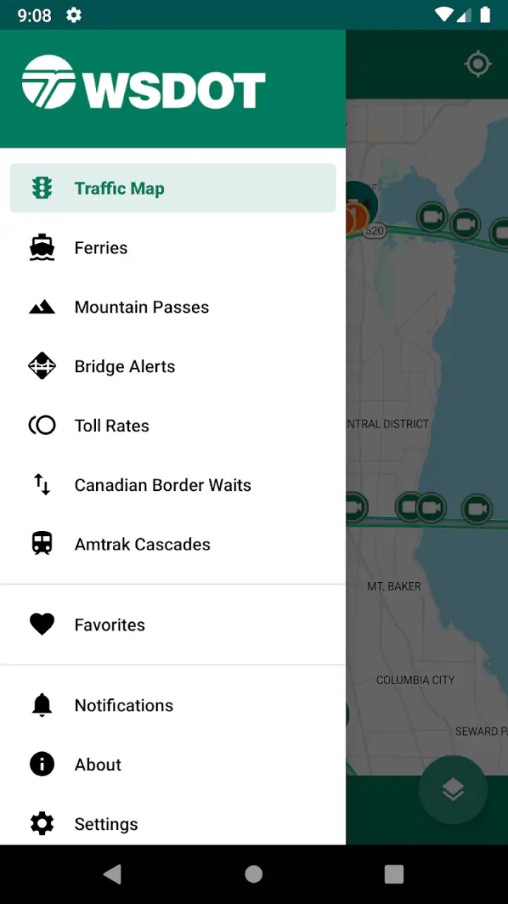
The WSDOT app is designed to help travelers plan trips across Washington State. It provides access to current traffic conditions, highway cameras, mountain pass information, ferry schedules and alerts, construction updates, and other transportation notices. It is especially useful before and during a journey because conditions can change quickly due to congestion, collisions, roadwork, weather, or ferry service disruptions.
Does the WSDOT app provide real-time traffic and road information?
Yes, the app offers regularly updated transportation information, including traffic conditions, incident reports, highway camera images, construction activity, and closures where available. However, users should remember that updates may not appear instantly in every situation. For safety, check the information before driving, enable appropriate alerts, and never interact with the app while operating a vehicle.
Can I check Washington State ferry schedules in the app?
The WSDOT app includes ferry-related information that can help passengers review schedules, sailing status, alerts, and service changes. Availability and details may vary by route and current operating conditions. Since ferry departures can be affected by weather, maintenance, vessel availability, or heavy demand, it is wise to confirm the latest information before leaving and arrive at the terminal with sufficient time.
Does WSDOT include mountain pass and winter travel information?
Yes, mountain pass information is one of the app’s most useful features for drivers traveling through Washington during winter or severe weather. Depending on the location, you may find pass conditions, restrictions, closures, traction requirements, and camera views. Conditions can change rapidly, so the app should support—not replace—proper preparation, including checking forecasts, carrying chains when required, and driving cautiously.
Is the WSDOT app free, and does it require an account?
The WSDOT app is generally available as a free download, and most of its transportation information can be accessed without creating a personal account. An internet connection or mobile data may be required for current updates, camera images, maps, and alerts. Data usage, notification permissions, and feature availability can vary by device, operating system, and the specific WSDOT service being viewed.
Pros
- Provides real-time traffic and road condition updates across Washington State.
- Offers camera views to check congestion
- weather
- and incidents before traveling.
- Includes ferry schedules
- alerts
- and route information for Washington crossings.
- Useful mountain pass reports with weather
- closures
- and traction requirements.
- Official data helps travelers make safer and better-informed driving decisions.
Cons
- Coverage is mainly limited to Washington State and nearby travel routes.
- Some information may update slowly during major storms or widespread outages.
- The interface can feel dated and less intuitive than modern navigation apps.
- It does not provide full turn-by-turn navigation like dedicated GPS apps.
- Frequent alerts may require notification settings to be adjusted manually.


